Geolocate

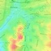
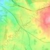
Camperdown topographic map

Click on the map to display elevation.

About this map

Name: Camperdown topographic map, elevation, terrain.

Location: Camperdown, Shire of Corangamite, Victoria, 3260, Australia (-38.27777 143.07568 -38.18031 143.21857)

Average elevation: 165 m

Minimum elevation: 101 m

Maximum elevation: 303 m

Other topographic maps

Click on a map to view its topography, its elevation and its terrain.
Brimbank Park

Australia > Victoria > Melbourne

Average elevation: 52 m

Lyonville

Australia > Victoria

Average elevation: 729 m

Mount Abrupt

Australia > Victoria

Average elevation: 422 m

Poverty Point

Australia > Victoria > Ballarat

Average elevation: 437 m

Warrenheip

Australia > Victoria > Ballarat

Average elevation: 532 m

Woolamai

Australia > Victoria

Average elevation: 62 m

East Pinnacle

Australia > Victoria

Average elevation: 1,099 m

Rutherford Park

Australia > Victoria

Average elevation: 519 m

Fawcett Hill

Australia > Victoria

Average elevation: 287 m

Mount Loch

Australia > Victoria

Average elevation: 1,648 m

Mount Albert

Australia > Victoria

Average elevation: 414 m

Renfew Court Reserve

Australia > Victoria > Melbourne

Average elevation: 131 m

Observatory Hill

Australia > Victoria > Portland

Average elevation: 9 m

Broadford

Australia > Victoria

Average elevation: 253 m

Gear up for your next adventure:

🦟Insect Repellent - Keep mosquitoes and black flies away in wooded areas
🧦Thermal Socks - Warm socks for winter hiking or camping
🧥Softshell Hiking Jacket - The perfect balance of wind protection and breathability
🌬️Windproof Camp Stove - Efficient cooking even on exposed mountain peaks
🥾Trekking Boots - Durable boots for long-distance trekking

As an Amazon Associate, this site earns from qualifying purchases at no extra cost to you.