
Thank you for supporting this site ❤️
Make a donation
Make a donation
Gear up for your next adventure:
As an Amazon Associate, this site earns from qualifying purchases at no extra cost to you.
Tambo topographic map
Click on the map to display elevation.
Thank you for supporting this site ❤️
Make a donation
Make a donation
Gear up for your next adventure:
As an Amazon Associate, this site earns from qualifying purchases at no extra cost to you.
About this map
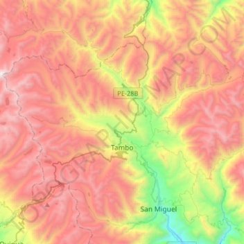
Name: Tambo topographic map, elevation, terrain.
Location: Tambo, Province of La Mar, Ayacucho, Peru (-12.99376 -74.14873 -12.83758 -73.88647)
Average elevation: 3,780 m
Minimum elevation: 2,476 m
Maximum elevation: 4,872 m
Thank you for supporting this site ❤️
Make a donation
Make a donation
Gear up for your next adventure:
As an Amazon Associate, this site earns from qualifying purchases at no extra cost to you.