Geolocate

Puerto Colombia topographic map

Click on the map to display elevation.

About this map

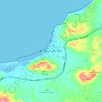
Name: Puerto Colombia topographic map, elevation, terrain.

Location: Puerto Colombia, Atlántico, RAP Caribe, 081001, Colombia (10.94913 -74.99541 11.02913 -74.91541)

Average elevation: 32 m

Minimum elevation: -1 m

Maximum elevation: 187 m

Gear up for your next adventure:

💧Hydration Bladder - Hands-free hydration solution for long treks
🦶Anti-Blister Balm - Prevents friction and hotspots during long ascents
📷Outdoor Action Camera - Capture high-elevation views and rugged adventures
🩹Compact First Aid Kit - Pre-packed essentials for common trail injuries
🌡️Emergency Mylar Blankets - Compact thermal protection for unexpected nights outdoors

As an Amazon Associate, this site earns from qualifying purchases at no extra cost to you.