
Thank you for supporting this site ❤️
Make a donation
Make a donation
Gear up for your next adventure:
As an Amazon Associate, this site earns from qualifying purchases at no extra cost to you.
Vicosoprano topographic map
Click on the map to display elevation.
Thank you for supporting this site ❤️
Make a donation
Make a donation
Gear up for your next adventure:
As an Amazon Associate, this site earns from qualifying purchases at no extra cost to you.
About this map
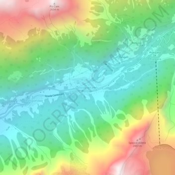
Name: Vicosoprano topographic map, elevation, terrain.
Location: Vicosoprano, Bregaglia, Maloja, Grisons, 7603, Switzerland (46.33074 9.60165 46.37074 9.64165)
Average elevation: 1,567 m
Minimum elevation: 1,003 m
Maximum elevation: 2,632 m
Thank you for supporting this site ❤️
Make a donation
Make a donation
Gear up for your next adventure:
As an Amazon Associate, this site earns from qualifying purchases at no extra cost to you.
Other topographic maps
Click on a map to view its topography, its elevation and its terrain.