Geolocate

Mansehra topographic map

Click on the map to display elevation.

About this map
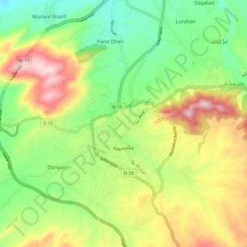
Name: Mansehra topographic map, elevation, terrain.

Location: Mansehra, Mansehra Tehsil, Mansehra District, Hazara Division, Khyber Pakhtunkhwa, Pakistan (34.29815 73.16883 34.37324 73.23579)

Average elevation: 1,091 m

Minimum elevation: 878 m

Maximum elevation: 1,402 m

Other topographic maps

Click on a map to view its topography, its elevation and its terrain.

Jaboree

Pakistan > Khyber Pakhtunkhwa > Mānsehra District

Average elevation: 1,610 m

Khakoo

Pakistan > Khyber Pakhtunkhwa > Mānsehra District

Average elevation: 1,513 m

Gali

Pakistan > Khyber Pakhtunkhwa > Mānsehra District > Bhati

Average elevation: 1,629 m

Oghi

Pakistan > Khyber Pakhtunkhwa > Mānsehra District

Average elevation: 1,264 m

Paras

Pakistan > Khyber Pakhtunkhwa > Mānsehra District

Average elevation: 1,757 m

Shogran

Pakistan > Khyber Pakhtunkhwa > Mānsehra District

Average elevation: 1,973 m

Jalkhad

Pakistan > Khyber Pakhtunkhwa > Mānsehra District

Average elevation: 3,565 m

Bedadi

Pakistan > Khyber Pakhtunkhwa > Mānsehra District

Average elevation: 1,012 m

Bafa

Pakistan > Khyber Pakhtunkhwa > Mānsehra District

Average elevation: 946 m

Jabori

Pakistan > Khyber Pakhtunkhwa > Mānsehra District

Average elevation: 1,107 m

Shogran

Pakistan > Khyber Pakhtunkhwa > Mānsehra District

Average elevation: 1,973 m

Gear up for your next adventure:

🧤Insulated Winter Gloves - Heavy-duty protection for sub-zero Canadian adventures
💡Portable Camping Lamp - Rechargeable lamp for campsite lighting
🧰Emergency Multi-Tool - Compact multi-tool for outdoor survival
⛺Lightweight Camping Tent - Portable shelter optimized for Canadian backcountry camping
🥤Collapsible Travel Cup - Saves space and weight in your mess kit

As an Amazon Associate, this site earns from qualifying purchases at no extra cost to you.