
Queen Valley topographic map
Click on the map to display elevation.
Queen Valley
Queen Valley is located at 33°17′42″N 111°17′52″W / 33.29500°N 111.29778°W / 33.29500; -111.29778. at an elevation of 2000 feet along the south side of the west flowing Queen Creek. The Tonto National Forest boundary and Comet Peak (2681 ft.) lie 1.5 miles to the east. The dam for the Whitlow Ranch Flood Control Basin is one mile to the east.
About this map
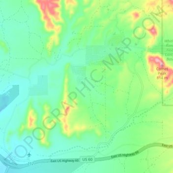
Name: Queen Valley topographic map, elevation, terrain.
Location: Queen Valley, Pinal County, Arizona, United States (33.25274 -111.34105 33.31838 -111.26798)
Average elevation: 633 m
Minimum elevation: 568 m
Maximum elevation: 804 m
Other topographic maps
Click on a map to view its topography, its elevation and its terrain.