
Thank you for supporting this site ❤️
Make a donation
Make a donation
Gear up for your next adventure:
As an Amazon Associate, this site earns from qualifying purchases at no extra cost to you.
Gondramaz topographic map
Click on the map to display elevation.
Thank you for supporting this site ❤️
Make a donation
Make a donation
Gear up for your next adventure:
As an Amazon Associate, this site earns from qualifying purchases at no extra cost to you.
About this map
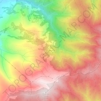
Name: Gondramaz topographic map, elevation, terrain.
Location: Gondramaz, Vila Nova, Miranda do Corvo, Coimbra, Portugal (40.04205 -8.29306 40.08205 -8.25306)
Average elevation: 635 m
Minimum elevation: 192 m
Maximum elevation: 940 m
Thank you for supporting this site ❤️
Make a donation
Make a donation
Gear up for your next adventure:
As an Amazon Associate, this site earns from qualifying purchases at no extra cost to you.