Geolocate

Wasco topographic map

Click on the map to display elevation.

Wasco

Wasco (formerly, Dewey and Deweyville) is a city in the San Joaquin Valley, in Kern County, California, United States. Wasco is located 24 miles (39 km) northwest of Bakersfield, at an elevation of 328 feet (100 m). The population was 25,545 at the 2010 census, up from 21,263 at the 2000 census.

Wikipedia (CC-BY-SA 3.0)

About this map

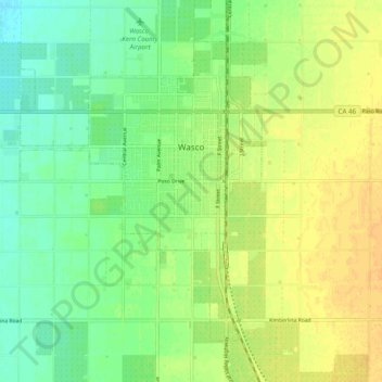
Name: Wasco topographic map, elevation, terrain.

Location: Wasco, Kern County, California, United States (35.55370 -119.42079 35.61609 -119.32281)

Average elevation: 101 m

Minimum elevation: 87 m

Maximum elevation: 115 m

Other topographic maps

Click on a map to view its topography, its elevation and its terrain.

Fruitvale

United States > California > Kern County

Average elevation: 122 m

Quality

United States > California > Kern County

Average elevation: 155 m

Rosedale

United States > California > Kern County

Average elevation: 113 m

Baker

United States > California > Kern County > Boron

Average elevation: 765 m

Rio Bravo

United States > California > Kern County

Average elevation: 97 m

Cameron

United States > California > Kern County

Average elevation: 1,309 m

Gear up for your next adventure:

🦟Insect Repellent - Keep mosquitoes and black flies away in wooded areas
🧴Bear Spray Holster - Quick-access carry for essential Canadian wilderness safety
🧦Crew Hiking Socks - Comfortable socks for long-distance hikes
🧢Hiking Hat - Sun-protective and breathable hats for long treks
Family Camping Tent - Spacious tent suitable for family camping trips

As an Amazon Associate, this site earns from qualifying purchases at no extra cost to you.