Geolocate

Burr Ridge topographic map

Click on the map to display elevation.

About this map

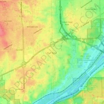
Name: Burr Ridge topographic map, elevation, terrain.

Location: Burr Ridge, DuPage County, Illinois, 65027, United States (41.71228 -87.94522 41.78957 -87.89267)

Average elevation: 209 m

Minimum elevation: 177 m

Maximum elevation: 242 m

Gear up for your next adventure:

🥾Waterproof Hiking Boots - Boots keeping your feet dry in wet conditions
🥾Hiking Shorts - Breathable shorts suitable for summer hikes
👟Leg Gaiters - Keep debris, mud, and snow out of your boots
Tent Footprint - Protect tent floor and increase durability
🧢Sun Hat - Wide-brim hat for sun protection

As an Amazon Associate, this site earns from qualifying purchases at no extra cost to you.