Geolocate

Arzúa topographic map

Click on the map to display elevation.

About this map

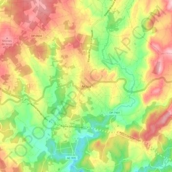
Name: Arzúa topographic map, elevation, terrain.

Location: Arzúa, A Coruña, Galicia, 15810, Spain (42.88799 -8.20057 42.96799 -8.12057)

Average elevation: 364 m

Minimum elevation: 258 m

Maximum elevation: 475 m

Gear up for your next adventure:

🎒Hiking Backpack - Lightweight and ergonomic backpacks for day hikes or multi-day treks
🧥Thermal Layer - Insulating layer for cold outdoor conditions
🛏️Camping Sleeping Mat - Comfortable mats for sleeping outdoors
🥽Outdoor Goggles - Protective eyewear for outdoor activities
🔦LED Headtorch - Bright and durable light for night activities

As an Amazon Associate, this site earns from qualifying purchases at no extra cost to you.