

Havana topographic map
Click on the map to display elevation.
Havana
There are low hills on which the city lies rise gently from the waters of the straits. A noteworthy elevation is the 200-foot-high (60-meter) limestone ridge that slopes up from the east and culminates in the heights of La Cabaña and El Morro, the sites of Spanish fortifications overlooking the eastern bay. Another notable rise is the hill to the west that is occupied by the University of Havana and the Castillo del Príncipe (Havana).
About this map
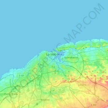
Name: Havana topographic map, elevation, terrain.
Location: Havana, La Habana Vieja, Havana, 10000, Cuba (22.97531 -82.51896 23.29531 -82.19896)
Average elevation: 30 m
Minimum elevation: 0 m
Maximum elevation: 196 m