
Saputara topographic map
Interactive map
Click on the map to display elevation.
About this map
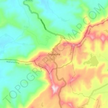
Name: Saputara topographic map, elevation, terrain.
Location: Saputara, Ahava Taluka, The Dangs, Gujarat, 394720, India (20.53967 73.70789 20.61967 73.78789)
Average elevation: 695 m
Minimum elevation: 451 m
Maximum elevation: 1,105 m