

Oeschinen Lake topographic map
Click on the map to display elevation.
Oeschinen Lake
Oeschinen Lake (German: Oeschinensee) is a lake in the Bernese Oberland, Switzerland, 4 kilometres (2.5 mi) east of Kandersteg in the Oeschinen valley. At an elevation of 1,578 metres (5,177 ft), it has a surface area of 1.1147 square kilometres (0.4304 sq mi). Its maximum depth is 56 metres (184 ft).
About this map
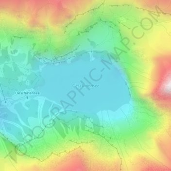
Name: Oeschinen Lake topographic map, elevation, terrain.
Average elevation: 1,918 m
Minimum elevation: 1,531 m
Maximum elevation: 2,668 m
Other topographic maps
Click on a map to view its topography, its elevation and its terrain.
Hockenhorn
Switzerland > Bern > Frutigen-Niedersimmental administrative district > Kandersteg
Average elevation: 2,599 m
Hockenhorn
Switzerland > Bern > Frutigen-Niedersimmental administrative district > Kandersteg
Average elevation: 2,599 m
First
Switzerland > Bern > Frutigen-Niedersimmental administrative district > Kandersteg
Average elevation: 2,008 m