Geolocate

Chala topographic map

Click on the map to display elevation.

About this map

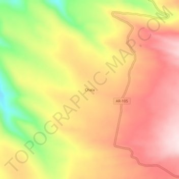
Name: Chala topographic map, elevation, terrain.

Location: Chala, Salamanca, Province of Condesuyos, Arequipa, Peru (-15.56264 -72.78283 -15.52264 -72.74283)

Average elevation: 4,628 m

Minimum elevation: 4,393 m

Maximum elevation: 4,787 m

Gear up for your next adventure:

🧥Softshell Hiking Jacket - The perfect balance of wind protection and breathability
🚲Handlebar Phone Mount - View topographic-map.com live while cycling
🥾Light Trekking Boots - Supportive boots for multi-day treks
🧴Waterproofing Spray - Restore the DWR coating on jackets and tents
🧦Outdoor Socks - Durable socks designed for hiking and outdoor sports

As an Amazon Associate, this site earns from qualifying purchases at no extra cost to you.