Geolocate

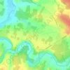
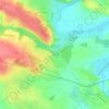
Durtal topographic map

Click on the map to display elevation.

About this map
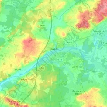
Name: Durtal topographic map, elevation, terrain.

Location: Durtal, Angers, Maine-et-Loire, Pays de la Loire, Metropolitan France, 49430, France (47.60560 -0.31762 47.72521 -0.17344)

Average elevation: 45 m

Minimum elevation: 16 m

Maximum elevation: 100 m

Other topographic maps

Click on a map to view its topography, its elevation and its terrain.

Cornu

France > Pays de la Loire > Maine-et-Loire > Terranjou

Average elevation: 53 m

Les Pentes

France > Pays de la Loire > Maine-et-Loire > Saumur

Average elevation: 49 m

Conception

France > Pays de la Loire > Maine-et-Loire

Average elevation: 72 m

Gallard

France > Pays de la Loire > Maine-et-Loire > Sèvremoine

Average elevation: 99 m

Gear up for your next adventure:

🧤Insulated Winter Gloves - Heavy-duty protection for sub-zero Canadian adventures
💡Compact LED Flashlight - Powerful and portable flashlight for outdoor use
🔨Vehicle Emergency Tool - Safety tool for remote road trips to trailheads
🔭Compact Binoculars - Lightweight optics for scouting trails and wildlife
🥾Waterproof Hiking Boots - Essential footwear for rugged terrain and wet Canadian trails

As an Amazon Associate, this site earns from qualifying purchases at no extra cost to you.