
Thank you for supporting this site ❤️
Make a donation
Make a donation
Gear up for your next adventure:
As an Amazon Associate, this site earns from qualifying purchases at no extra cost to you.
Lae topographic map
Click on the map to display elevation.
Thank you for supporting this site ❤️
Make a donation
Make a donation
Gear up for your next adventure:
As an Amazon Associate, this site earns from qualifying purchases at no extra cost to you.
About this map
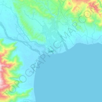
Name: Lae topographic map, elevation, terrain.
Location: Lae, Lae District, Morobe, Momase Region, Papua New Guinea (-6.89020 146.84081 -6.57020 147.16081)
Average elevation: 162 m
Minimum elevation: 0 m
Maximum elevation: 1,702 m
Thank you for supporting this site ❤️
Make a donation
Make a donation
Gear up for your next adventure:
As an Amazon Associate, this site earns from qualifying purchases at no extra cost to you.