
Thank you for supporting this site ❤️
Make a donation
Make a donation
Gear up for your next adventure:
As an Amazon Associate, this site earns from qualifying purchases at no extra cost to you.
Klingenburg topographic map
Click on the map to display elevation.
Thank you for supporting this site ❤️
Make a donation
Make a donation
Gear up for your next adventure:
As an Amazon Associate, this site earns from qualifying purchases at no extra cost to you.
About this map
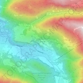
Name: Klingenburg topographic map, elevation, terrain.
Location: Klingenburg, Oetz, Bezirk Imst, Tyrol, 6433, Austria (47.18917 10.87399 47.22917 10.91399)
Average elevation: 1,162 m
Minimum elevation: 734 m
Maximum elevation: 1,867 m
Thank you for supporting this site ❤️
Make a donation
Make a donation
Gear up for your next adventure:
As an Amazon Associate, this site earns from qualifying purchases at no extra cost to you.