Geolocate

Mucajaí topographic map

Click on the map to display elevation.

About this map
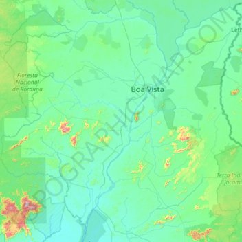
Name: Mucajaí topographic map, elevation, terrain.

Location: Mucajaí, Região Geográfica Imediata de Boa Vista, Região Geográfica Intermediária de Boa Vista, Roraima, North Region, Brazil (2.10310 -63.08200 2.94841 -60.83500)

Average elevation: 135 m

Minimum elevation: 38 m

Maximum elevation: 1,739 m

Other topographic maps

Click on a map to view its topography, its elevation and its terrain.

Caracarai

Brazil > Roraima > Boa Vista

Average elevation: 74 m

Santo Luis

Brazil > Roraima > Alto Alegre

Average elevation: 97 m

Gear up for your next adventure:

👟Trail Running Shoes - Agile footwear for fast-paced topographic exploration
🥾Waterproof Hiking Shoes - Durable shoes for wet and rugged trails
☕Camping Coffee Maker - Brew fresh coffee anywhere on the topographic map
🦶Anti-Blister Balm - Prevents friction and hotspots during long ascents
👟Sport Hiking Sandals - Breathable footwear for water crossings and camp rest

As an Amazon Associate, this site earns from qualifying purchases at no extra cost to you.