Geolocate

Le Penon topographic map

Click on the map to display elevation.

About this map
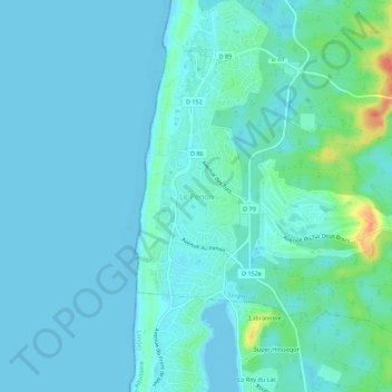
Name: Le Penon topographic map, elevation, terrain.

Location: Le Penon, Seignosse, District of Dax, Landes, Nouvelle-Aquitaine, Metropolitan France, 40510, France (43.67349 -1.45293 43.71349 -1.41293)

Average elevation: 8 m

Minimum elevation: -2 m

Maximum elevation: 50 m

Other topographic maps

Click on a map to view its topography, its elevation and its terrain.

Gabarret

France > Nouvelle-Aquitaine > Landes

Average elevation: 149 m

Mézos

France > Nouvelle-Aquitaine > Landes

Average elevation: 40 m

Mont-de-Marsan

France > Nouvelle-Aquitaine > Landes

Average elevation: 65 m

Peyre

France > Nouvelle-Aquitaine > Landes

Average elevation: 98 m

40330

France > Nouvelle-Aquitaine > Landes > Amou

Average elevation: 76 m

Gear up for your next adventure:

🧼Travel Hand Sanitizer - Keep hands clean when water is scarce
🧢Sun Protection Cap - Breathable cap to protect from sun exposure
🧴First Aid Kit - Essential first aid supplies for outdoor emergencies
🧭GPS Handheld Device - Reliable GPS navigation for outdoor adventures
❄️Traction Ice Cleats - Slip-on spikes for icy trails and winter hiking

As an Amazon Associate, this site earns from qualifying purchases at no extra cost to you.