Geolocate

Toledo topographic map

Click on the map to display elevation.

About this map

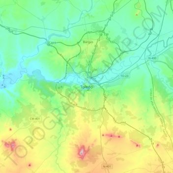
Name: Toledo topographic map, elevation, terrain.

Location: Toledo, Castile-La Mancha, 45002, Spain (39.69607 -4.18396 40.01607 -3.86396)

Average elevation: 590 m

Minimum elevation: 429 m

Maximum elevation: 1,072 m

Gear up for your next adventure:

Family Camping Tent - Spacious tent suitable for family camping trips
🥫Freeze-Dried Meals - Lightweight, high-calorie nutrition for multi-day treks
🚑Survival Whistle - Signal for help across long distances in mountains
🧥Thermal Layer - Insulating layer for cold outdoor conditions
👟Sport Hiking Sandals - Breathable footwear for water crossings and camp rest

As an Amazon Associate, this site earns from qualifying purchases at no extra cost to you.