Geolocate

Nazareth topographic map

Click on the map to display elevation.

About this map
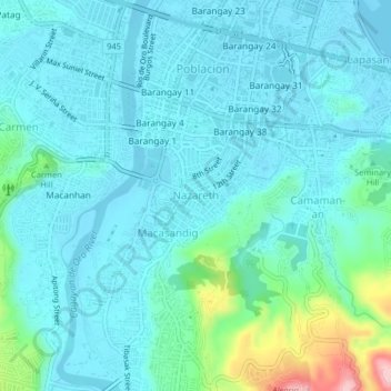
Name: Nazareth topographic map, elevation, terrain.

Location: Nazareth, Cagayan de Oro, Northern Mindanao, 9000, Philippines (8.44934 124.62704 8.48934 124.66704)

Average elevation: 33 m

Minimum elevation: -4 m

Maximum elevation: 207 m

Other topographic maps

Click on a map to view its topography, its elevation and its terrain.

Gear up for your next adventure:

🥘Camping Cookware Set - Compact nesting pots and pans for trail cooking
🧢Sun Protection Cap - Breathable cap to protect from sun exposure
🧥Packable Rain Jacket - Breathable waterproof layer for unpredictable weather
🛌Down Sleeping Bag - Superior warmth-to-weight ratio for cold nights
🐕Hiking Dog Pack - Let your canine companion carry their own water and food

As an Amazon Associate, this site earns from qualifying purchases at no extra cost to you.