Geolocate

Rotonda topographic map

Click on the map to display elevation.

About this map

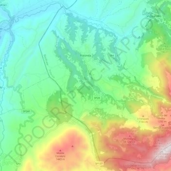
Name: Rotonda topographic map, elevation, terrain.

Location: Rotonda, Potenza, Basilicata, Italy (39.89581 16.00759 39.97854 16.12299)

Average elevation: 741 m

Minimum elevation: 270 m

Maximum elevation: 1,792 m

Gear up for your next adventure:

🧦Merino Wool Socks - Moisture-wicking comfort for long-distance hiking
🥾Trekking Poles - Adjustable trekking poles to reduce knee stress and improve stability
🥾Light Hiking Boots - Lightweight and comfortable boots for day hikes
🥾Mountaineering Boots - Supportive boots for climbing and high-altitude hiking
🧦Outdoor Socks - Durable socks designed for hiking and outdoor sports

As an Amazon Associate, this site earns from qualifying purchases at no extra cost to you.