Geolocate

Werl topographic map

Click on the map to display elevation.

About this map
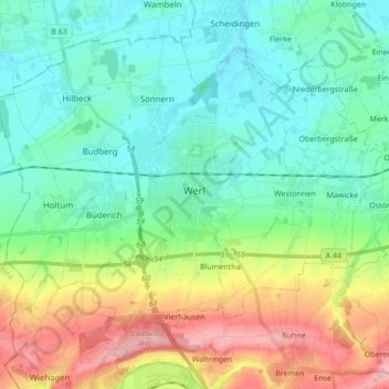
Name: Werl topographic map, elevation, terrain.

Location: Werl, Kreis Soest, North Rhine-Westphalia, 59457, Germany (51.50876 7.82709 51.59581 7.99856)

Average elevation: 122 m

Minimum elevation: 71 m

Maximum elevation: 245 m

Gear up for your next adventure:

🥾Trail Running Boots - Durable shoes designed for trail running
🛶Kayak Dry Bag - Waterproof storage for kayaking adventures
🧥Thermal Layer - Insulating layer for cold outdoor conditions
🧥Ultralight Puffy Jacket - Maximum warmth that packs down to the size of an orange
🧦Hiking Liner Socks - Thin base layer to prevent friction and blisters

As an Amazon Associate, this site earns from qualifying purchases at no extra cost to you.