
Thank you for supporting this site ❤️
Make a donation
Make a donation
Gear up for your next adventure:
As an Amazon Associate, this site earns from qualifying purchases at no extra cost to you.
Sonnenstein topographic map
Click on the map to display elevation.
Thank you for supporting this site ❤️
Make a donation
Make a donation
Gear up for your next adventure:
As an Amazon Associate, this site earns from qualifying purchases at no extra cost to you.
About this map
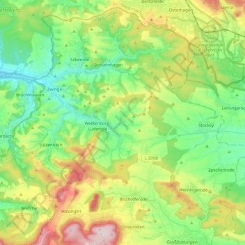
Name: Sonnenstein topographic map, elevation, terrain.
Location: Sonnenstein, Landkreis Eichsfeld, Thuringia, Germany (51.47781 10.34308 51.59270 10.53953)
Average elevation: 295 m
Minimum elevation: 168 m
Maximum elevation: 530 m
Thank you for supporting this site ❤️
Make a donation
Make a donation
Gear up for your next adventure:
As an Amazon Associate, this site earns from qualifying purchases at no extra cost to you.