Geolocate

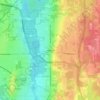
Cortland topographic map

Click on the map to display elevation.

About this map

Name: Cortland topographic map, elevation, terrain.

Location: Cortland, Trumbull County, Ohio, United States (41.30575 -80.74151 41.35151 -80.70100)

Average elevation: 305 m

Minimum elevation: 273 m

Maximum elevation: 339 m

Other topographic maps

Click on a map to view its topography, its elevation and its terrain.
Howland Township

United States > Ohio > Trumbull County

Average elevation: 299 m

Vienna

United States > Ohio > Trumbull County

Average elevation: 342 m

Vienna Township

United States > Ohio > Trumbull County

Average elevation: 342 m

Burghill

United States > Ohio > Trumbull County > Vernon Township

Average elevation: 311 m

Gear up for your next adventure:

🧥Ultralight Puffy Jacket - Maximum warmth that packs down to the size of an orange
💧Hydration Pack - Hands-free hydration system for long hikes
📷Outdoor Action Camera - Capture high-elevation views and rugged adventures
🧴First Aid Kit - Essential first aid supplies for outdoor emergencies
🧴Outdoor Sunscreen - High SPF protection for high-altitude UV exposure

As an Amazon Associate, this site earns from qualifying purchases at no extra cost to you.