Geolocate

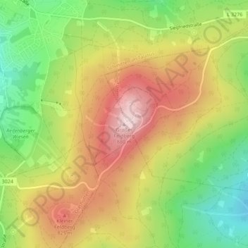
Großer Feldberg topographic map

Click on the map to display elevation.

Großer Feldberg

The Großer Feldberg ('Great Field Mountain') is, at a height of 879.5 metres, the highest elevation of the Taunus mountains, and of the entire Rhenish Massif. It is situated in the Hochtaunuskreis district in Hesse, Germany.

Wikipedia (CC-BY-SA 3.0)

About this map

Name: Großer Feldberg topographic map, elevation, terrain.

Location: Großer Feldberg, Schmitten im Taunus, Hochtaunuskreis, Hesse, 61389, Germany (50.23177 8.45678 50.23187 8.45688)

Average elevation: 716 m

Minimum elevation: 549 m

Maximum elevation: 884 m

Gear up for your next adventure:

💧Hydration Pack - Hands-free hydration system for long hikes
💡LED Camping Lantern - Illuminate your campsite with long-lasting lanterns
🎒Hiking Backpack - Lightweight and ergonomic backpacks for day hikes or multi-day treks
🧥Waterproof Pants - Keep dry during rainy hiking conditions
🚲Handlebar Phone Mount - View topographic-map.com live while cycling

As an Amazon Associate, this site earns from qualifying purchases at no extra cost to you.