Geolocate

Egypt topographic map

Click on the map to display elevation.

About this map

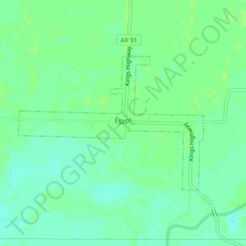
Name: Egypt topographic map, elevation, terrain.

Location: Egypt, Craighead County, Arkansas, 72427, United States (35.86048 -90.95986 35.87515 -90.93477)

Average elevation: 76 m

Minimum elevation: 70 m

Maximum elevation: 79 m

Gear up for your next adventure:

🥾Trekking Boots - Durable boots for long-distance trekking
🔋Lithium AA Batteries - Long-lasting power that performs in extreme cold
🥾Trekking Poles - Adjustable trekking poles to reduce knee stress and improve stability
🎒Fully Waterproof Backpack - Total protection for photography gear and electronics
🩹Compact First Aid Kit - Pre-packed essentials for common trail injuries

As an Amazon Associate, this site earns from qualifying purchases at no extra cost to you.