Geolocate

Omaha topographic map

Click on the map to display elevation.

About this map

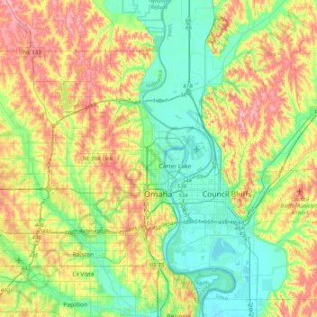
Name: Omaha topographic map, elevation, terrain.

Location: Omaha, Douglas County, Nebraska, United States (41.19059 -96.26820 41.39306 -95.87114)

Average elevation: 338 m

Minimum elevation: 291 m

Maximum elevation: 413 m

Other topographic maps

Click on a map to view its topography, its elevation and its terrain.

King Lake

United States > Nebraska > Douglas County

Average elevation: 345 m

Omaha

United States > Nebraska > Douglas County > Omaha

Average elevation: 339 m

Gear up for your next adventure:

🥾Light Hiking Boots - Lightweight and comfortable boots for day hikes
🥾Waterproof Trail Shoes - Shoes designed to handle wet terrain
🛶Canoe Life Vest - Safety vest for water sports
💧Collapsible Water Bottle - Space-saving water bottle for outdoor activities
🧭GPS Tracker - Track your location in remote areas safely

As an Amazon Associate, this site earns from qualifying purchases at no extra cost to you.