Geolocate

Gillette topographic map

Click on the map to display elevation.

About this map

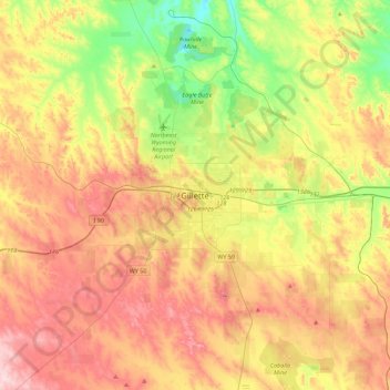
Name: Gillette topographic map, elevation, terrain.

Location: Gillette, Campbell County, Wyoming, 82716, United States (44.13064 -105.66188 44.45064 -105.34188)

Average elevation: 1,394 m

Minimum elevation: 1,236 m

Maximum elevation: 1,568 m

Gear up for your next adventure:

💧Filtered Water Bottle - Safe drinking water on the go
🧦Crew Hiking Socks - Comfortable socks for long-distance hikes
Camping Groundsheet - Protect your tent from moisture and dirt
🧥Waterproof Jacket - Lightweight rain jackets for hiking and outdoor activities
🧥Fleece Jacket - Warm and lightweight jacket for layering

As an Amazon Associate, this site earns from qualifying purchases at no extra cost to you.