Geolocate

Leon Valley topographic map

Click on the map to display elevation.

About this map

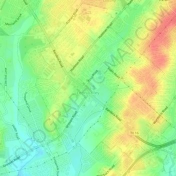
Name: Leon Valley topographic map, elevation, terrain.

Location: Leon Valley, Bexar County, Texas, United States (29.47686 -98.63238 29.51561 -98.58636)

Average elevation: 260 m

Minimum elevation: 233 m

Maximum elevation: 291 m

Gear up for your next adventure:

🧥Softshell Jacket - Windproof and breathable jacket for hiking
🥤Collapsible Travel Cup - Saves space and weight in your mess kit
🧣Evaporative Cooling Towel - Beat the heat during intense summer climbs
🚲Bike Repair Kit - Essential tools for on-trail mechanical issues
🧦Hiking Liner Socks - Thin base layer to prevent friction and blisters

As an Amazon Associate, this site earns from qualifying purchases at no extra cost to you.