Geolocate

Sunny Brae topographic map

Click on the map to display elevation.

About this map
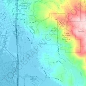
Name: Sunny Brae topographic map, elevation, terrain.

Location: Sunny Brae, Arcata, Humboldt County, California, 95521, United States (40.83818 -124.08645 40.87818 -124.04645)

Average elevation: 82 m

Minimum elevation: -2 m

Maximum elevation: 357 m

Other topographic maps

Click on a map to view its topography, its elevation and its terrain.

Gear up for your next adventure:

🧭GPS Tracker - Track your location in remote areas safely
🎒Fully Waterproof Backpack - Total protection for photography gear and electronics
🧭Orienteering Kit - Tools for map reading and navigation in the wild
💡Compact LED Flashlight - Powerful and portable flashlight for outdoor use
🧥Softshell Hiking Jacket - The perfect balance of wind protection and breathability

As an Amazon Associate, this site earns from qualifying purchases at no extra cost to you.