Geolocate

Franklin topographic map

Click on the map to display elevation.

About this map

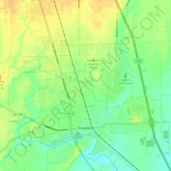
Name: Franklin topographic map, elevation, terrain.

Location: Franklin, Johnson County, Indiana, 46131, United States (39.45993 -86.09377 39.54228 -86.00277)

Average elevation: 230 m

Minimum elevation: 214 m

Maximum elevation: 250 m

Gear up for your next adventure:

🥾Trekking Boots - Durable boots for long-distance trekking
🛌Insulated Sleeping Pad - Critical thermal barrier between you and the cold ground
🕶️Polarized Sunglasses - Reduces glare from snow and water at high elevations
🍽️Titanium Camping Spork - Ultralight and indestructible eating utensil
🩹Moleskin Blister Pads - Direct protection for painful foot pressure points

As an Amazon Associate, this site earns from qualifying purchases at no extra cost to you.