Geolocate

San Rafael topographic map

Click on the map to display elevation.

About this map

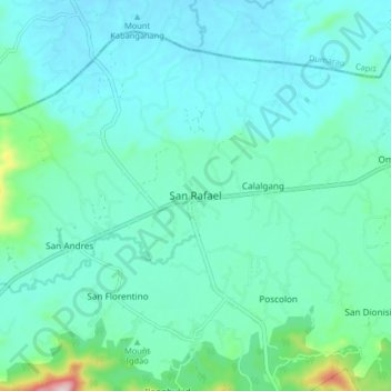
Name: San Rafael topographic map, elevation, terrain.

Location: San Rafael, Iloilo, Western Visayas, 5039, Philippines (11.14013 122.78885 11.22013 122.86885)

Average elevation: 120 m

Minimum elevation: 60 m

Maximum elevation: 451 m

Other topographic maps

Click on a map to view its topography, its elevation and its terrain.

Dumangas

Philippines > Iloilo

Average elevation: 8 m

Gear up for your next adventure:

🥾Mountain Trail Shoes - High-traction shoes for mountain trails
🧰Survival Kit - Essential gear for emergencies in the wilderness
🔋Emergency Crank Radio - Weather alerts and power without needing batteries
🧊Insulated Water Bottle - Keeps drinks cold in summer and prevents freezing in winter
Tent Footprint - Protect tent floor and increase durability

As an Amazon Associate, this site earns from qualifying purchases at no extra cost to you.