
Molalla topographic map
Click on the map to display elevation.
About this map
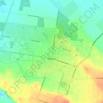
Name: Molalla topographic map, elevation, terrain.
Location: Molalla, Clackamas County, Oregon, 97038, United States (45.13724 -122.61278 45.16290 -122.55827)
Average elevation: 113 m
Minimum elevation: 88 m
Maximum elevation: 151 m
Other topographic maps
Click on a map to view its topography, its elevation and its terrain.
Boring
United States > Oregon > Clackamas County
Boring's landscape is hilly, with its elevation ranging between 548 feet (167 m) and 755 feet (230 m). Several creeks run west through the community limits into the Clackamas River, including Doane Creek, North Fork Deep Creek, and Tickle Creek.
Average elevation: 183 m