
San Benito County topographic map
Interactive map
Click on the map to display elevation.
About this map
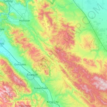
Name: San Benito County topographic map, elevation, terrain.
Location: San Benito County, California, United States (36.19677 -121.64374 36.98890 -120.59666)
Average elevation: 454 m
Minimum elevation: 8 m
Maximum elevation: 1,563 m
Other topographic maps
Click on a map to view its topography, its elevation and its terrain.
Hollister
United States > California > San Benito County
Hollister, San Benito County, California, 95023, United States
Average elevation: 92 m