Geolocate

Hindås topographic map

Click on the map to display elevation.

About this map

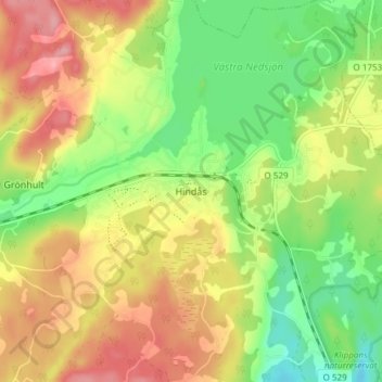
Name: Hindås topographic map, elevation, terrain.

Location: Hindås, Härryda kommun, Västra Götaland County, 438 53, Sweden (57.68282 12.43119 57.72282 12.47119)

Average elevation: 146 m

Minimum elevation: 92 m

Maximum elevation: 204 m

Gear up for your next adventure:

🚲MTB Frame Bag - Carry tools and maps directly on your bicycle frame
🥾Hiking Gaiters - Protect legs and shoes from mud, snow, and debris
🥾Durable Hiking Shoes - Long-lasting shoes for frequent hiking
🥫Freeze-Dried Meals - Lightweight, high-calorie nutrition for multi-day treks
🧥Ultralight Puffy Jacket - Maximum warmth that packs down to the size of an orange

As an Amazon Associate, this site earns from qualifying purchases at no extra cost to you.