
Zeitlofs topographic map
Click on the map to display elevation.
About this map
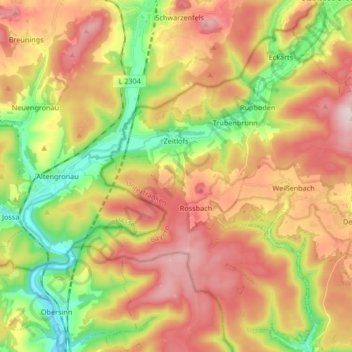
Name: Zeitlofs topographic map, elevation, terrain.
Location: Zeitlofs, Landkreis Bad Kissingen, Bavaria, 97799, Germany (50.20579 9.62356 50.29497 9.79018)
Average elevation: 371 m
Minimum elevation: 195 m
Maximum elevation: 546 m
Other topographic maps
Click on a map to view its topography, its elevation and its terrain.
Hammelburg
Germany > Bavaria > Landkreis Bad Kissingen > Hammelburg > Hammelburg
Average elevation: 260 m
Bad Kissingen
Germany > Bavaria > Landkreis Bad Kissingen > Bad Kissingen > Bad Kissingen
Average elevation: 295 m