Geolocate

Neskuchne topographic map

Click on the map to display elevation.

About this map
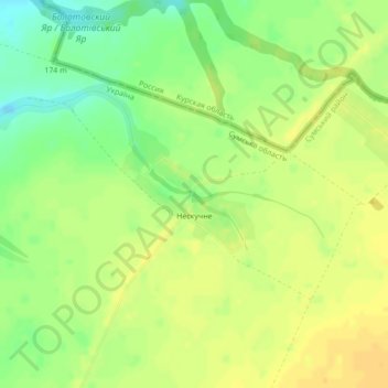
Name: Neskuchne topographic map, elevation, terrain.

Location: Neskuchne, Білопільська міська громада, Sumy Raion, Sumy Oblast, 41823, Ukraine (51.24887 34.42011 51.25787 34.43768)

Average elevation: 183 m

Minimum elevation: 166 m

Maximum elevation: 193 m

Other topographic maps

Click on a map to view its topography, its elevation and its terrain.

Shostka

Ukraine > Sumy Oblast

Average elevation: 150 m

Pishchane

Ukraine > Sumy Oblast

Average elevation: 181 m

Pisky

Ukraine > Sumy Oblast

Average elevation: 130 m

Gear up for your next adventure:

🚑Survival Whistle - Signal for help across long distances in mountains
💡LED Camping Lantern - Illuminate your campsite with long-lasting lanterns
🧴First Aid Kit - Essential first aid supplies for outdoor emergencies
🦶Anti-Blister Balm - Prevents friction and hotspots during long ascents
🔭Compact Binoculars - Lightweight optics for scouting trails and wildlife

As an Amazon Associate, this site earns from qualifying purchases at no extra cost to you.