Geolocate

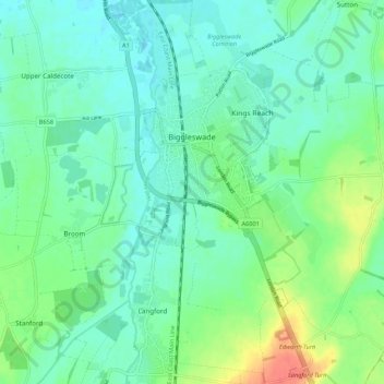
Biggleswade topographic map

Click on the map to display elevation.

Biggleswade

Elevation

Wikipedia (CC-BY-SA 3.0)

About this map

Name: Biggleswade topographic map, elevation, terrain.

Location: Biggleswade, Central Bedfordshire, England, United Kingdom (52.04552 -0.27566 52.11169 -0.21501)

Average elevation: 37 m

Minimum elevation: 22 m

Maximum elevation: 79 m

Other topographic maps

Click on a map to view its topography, its elevation and its terrain.
Gear up for your next adventure:

🛰️Satellite Messenger - Emergency communication for areas with no cell service
❄️Traction Ice Cleats - Slip-on spikes for icy trails and winter hiking
🥾Trekking Poles - Adjustable trekking poles to reduce knee stress and improve stability
🛌Insulated Sleeping Pad - Critical thermal barrier between you and the cold ground
🧰Survival Kit - Essential gear for emergencies in the wilderness

As an Amazon Associate, this site earns from qualifying purchases at no extra cost to you.