Geolocate

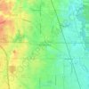
Evanston topographic map

Click on the map to display elevation.

About this map

Name: Evanston topographic map, elevation, terrain.

Location: Evanston, Evanston Township, Cook County, Illinois, United States (42.01915 -87.73246 42.07177 -87.66502)

Average elevation: 184 m

Minimum elevation: 175 m

Maximum elevation: 198 m

Other topographic maps

Click on a map to view its topography, its elevation and its terrain.
Symphony Lake

United States > Illinois > Cook County > Chicago

Average elevation: 181 m

Gear up for your next adventure:

⛺Lightweight Camping Tent - Portable shelter optimized for Canadian backcountry camping
🧭GPS Handheld Device - Reliable GPS navigation for outdoor adventures
⛺Lightweight Backpacking Tent - Compact tent for efficient hiking trips
⛺Camping Essentials - All-in-one gear for a comfortable camping trip
🌬️Windproof Camp Stove - Efficient cooking even on exposed mountain peaks

As an Amazon Associate, this site earns from qualifying purchases at no extra cost to you.