
Hội An topographic map
Interactive map
Click on the map to display elevation.
About this map
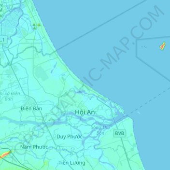
Name: Hội An topographic map, elevation, terrain.
Location: Hội An, Quảng Nam Province, Vietnam (15.85538 108.28952 15.98027 108.54309)
Average elevation: 4 m
Minimum elevation: -3 m
Maximum elevation: 149 m
Other topographic maps
Click on a map to view its topography, its elevation and its terrain.
Tam Kỳ City
Tam Kỳ City, Quảng Nam Province, Vietnam
Average elevation: 10 m