Geolocate

North Vancouver topographic map

Click on the map to display elevation.

About this map
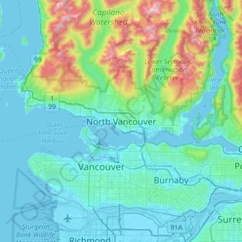
Name: North Vancouver topographic map, elevation, terrain.

Location: North Vancouver, Metro Vancouver Regional District, British Columbia, V7M 1H9, Canada (49.16071 -123.23378 49.48071 -122.91378)

Average elevation: 258 m

Minimum elevation: -4 m

Maximum elevation: 1,685 m

British Columbia trails, hiking, mountain biking, running and outdoor activities

Other topographic maps

Click on a map to view its topography, its elevation and its terrain.
Gear up for your next adventure:

⛺Family Camping Tent - Spacious tent suitable for family camping trips
🎒Backpack Rain Cover - External shield to keep your entire pack dry
🥾Trail Running Boots - Durable shoes designed for trail running
🥾Mountaineering Boots - Supportive boots for climbing and high-altitude hiking
🛏️Camping Sleeping Mat - Comfortable mats for sleeping outdoors

As an Amazon Associate, this site earns from qualifying purchases at no extra cost to you.