Geolocate

Pueblo Bello topographic map

Click on the map to display elevation.

About this map

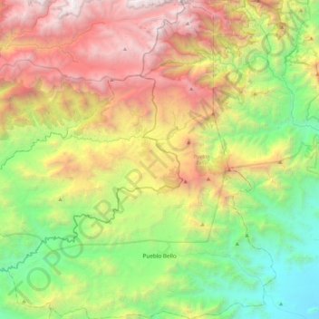
Name: Pueblo Bello topographic map, elevation, terrain.

Location: Pueblo Bello, Cesar, RAP Caribe, Colombia (10.32984 -73.79062 10.74170 -73.43786)

Average elevation: 1,805 m

Minimum elevation: 125 m

Maximum elevation: 4,469 m

Other topographic maps

Click on a map to view its topography, its elevation and its terrain.

Río Badillo

Colombia > Cesar > Villanueva

Average elevation: 353 m

Gear up for your next adventure:

🧣Merino Neck Gaiter - Protects against wind, sun, and cold at high altitudes
🥾Hiking Leggings - Comfortable leggings for outdoor activities
💡Portable Camping Lamp - Rechargeable lamp for campsite lighting
Family Camping Tent - Spacious tent suitable for family camping trips
👖Convertible Hiking Pants - Zip-off legs to adapt to changing weather conditions

As an Amazon Associate, this site earns from qualifying purchases at no extra cost to you.