Geolocate

Sharnbrook topographic map

Click on the map to display elevation.

About this map

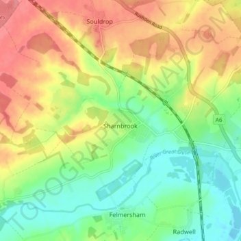
Name: Sharnbrook topographic map, elevation, terrain.

Location: Sharnbrook, Bedford, England, United Kingdom (52.20970 -0.58365 52.24331 -0.51033)

Average elevation: 68 m

Minimum elevation: 35 m

Maximum elevation: 107 m

Gear up for your next adventure:

🧥Thermal Fleece Jacket - Versatile insulation for changing mountain temperatures
🦶Hiking Shoe Insoles - Added support for high arches and long days on feet
🛶Canoe Life Vest - Safety vest for water sports
💡Portable Camping Lamp - Rechargeable lamp for campsite lighting
💡Solar Camping Lamp - Eco-friendly lighting for campsites

As an Amazon Associate, this site earns from qualifying purchases at no extra cost to you.