
Thank you for supporting this site ❤️
Make a donation
Make a donation
Gear up for your next adventure:
As an Amazon Associate, this site earns from qualifying purchases at no extra cost to you.
Mauterndorf topographic map
Click on the map to display elevation.
Thank you for supporting this site ❤️
Make a donation
Make a donation
Gear up for your next adventure:
As an Amazon Associate, this site earns from qualifying purchases at no extra cost to you.
About this map
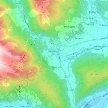
Name: Mauterndorf topographic map, elevation, terrain.
Location: Mauterndorf, Bezirk Tamsweg, Salzburg, 5570, Austria (47.09874 13.61996 47.16521 13.71740)
Average elevation: 1,377 m
Minimum elevation: 1,017 m
Maximum elevation: 2,241 m
Thank you for supporting this site ❤️
Make a donation
Make a donation
Gear up for your next adventure:
As an Amazon Associate, this site earns from qualifying purchases at no extra cost to you.