Geolocate

Huez topographic map

Click on the map to display elevation.

About this map
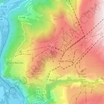
Name: Huez topographic map, elevation, terrain.

Location: Huez, Grenoble, Isère, Auvergne-Rhône-Alpes, Metropolitan France, 38750, France (45.07053 6.04145 45.12411 6.12095)

Average elevation: 1,566 m

Minimum elevation: 707 m

Maximum elevation: 2,464 m

Other topographic maps

Click on a map to view its topography, its elevation and its terrain.

Gear up for your next adventure:

🥫Freeze-Dried Meals - Lightweight, high-calorie nutrition for multi-day treks
💡Solar Camping Lamp - Eco-friendly lighting for campsites
🚑Survival Whistle - Signal for help across long distances in mountains
🚲Handlebar Phone Mount - View topographic-map.com live while cycling
👟Trail Running Shoes - Agile footwear for fast-paced topographic exploration

As an Amazon Associate, this site earns from qualifying purchases at no extra cost to you.