Geolocate

Harmony topographic map

Click on the map to display elevation.

About this map

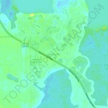
Name: Harmony topographic map, elevation, terrain.

Location: Harmony, Osceola County, Florida, United States (28.16946 -81.16507 28.20946 -81.12507)

Average elevation: 22 m

Minimum elevation: 16 m

Maximum elevation: 32 m

Gear up for your next adventure:

🥾Trekking Poles - Adjustable trekking poles to reduce knee stress and improve stability
🥾Hiking Boots - Sturdy boots providing ankle support and traction on rugged trails
🎒Backpack Rain Cover - External shield to keep your entire pack dry
🏃Hydration Running Vest - Carry water and maps close to your body for speed
🧢Sun Hat - Wide-brim hat for sun protection

As an Amazon Associate, this site earns from qualifying purchases at no extra cost to you.