Geolocate

Coburg topographic map

Click on the map to display elevation.

About this map
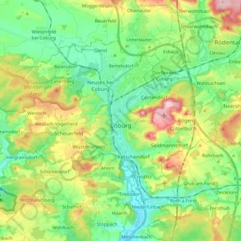
Name: Coburg topographic map, elevation, terrain.

Location: Coburg, Bavaria, 96450, Germany (50.22175 10.88687 50.29894 11.06376)

Average elevation: 339 m

Minimum elevation: 275 m

Maximum elevation: 462 m

Other topographic maps

Click on a map to view its topography, its elevation and its terrain.

Münchshofen

Germany > Bavaria > Landkreis Schwandorf > Teublitz

Average elevation: 378 m

Kapfing

Germany > Bavaria > Landkreis Deggendorf

Average elevation: 484 m

Gear up for your next adventure:

🧦Outdoor Socks - Durable socks designed for hiking and outdoor sports
🔋Solar Power Bank - Keep your GPS and devices charged during long outdoor trips
⛺Camping Tent - Weather-resistant tents suitable for 2 to 6 people
💡LED Camping Lantern - Illuminate your campsite with long-lasting lanterns
🥾Trail Running Shoes - Lightweight and durable shoes for trail running

As an Amazon Associate, this site earns from qualifying purchases at no extra cost to you.