Geolocate

Sentosa topographic map

Click on the map to display elevation.

About this map
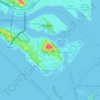
Name: Sentosa topographic map, elevation, terrain.

Location: Sentosa, Southwest, Singapore (1.23780 103.80655 1.26013 103.84841)

Average elevation: 5 m

Minimum elevation: -3 m

Maximum elevation: 75 m

Other topographic maps

Click on a map to view its topography, its elevation and its terrain.
Newton Circus

Singapore > Singapore

Average elevation: 19 m

Gear up for your next adventure:

👟Trail Running Shoes - Agile footwear for fast-paced topographic exploration
🔋Emergency Crank Radio - Weather alerts and power without needing batteries
🧥Softshell Hiking Jacket - The perfect balance of wind protection and breathability
💧Reusable Water Bottle - Durable water bottles for hydration on trails
🛌Insulated Sleeping Pad - Critical thermal barrier between you and the cold ground

As an Amazon Associate, this site earns from qualifying purchases at no extra cost to you.