
Thank you for supporting this site ❤️
Make a donation
Make a donation
Gear up for your next adventure:
As an Amazon Associate, this site earns from qualifying purchases at no extra cost to you.
Bahlā topographic map
Click on the map to display elevation.
Thank you for supporting this site ❤️
Make a donation
Make a donation
Gear up for your next adventure:
As an Amazon Associate, this site earns from qualifying purchases at no extra cost to you.
About this map
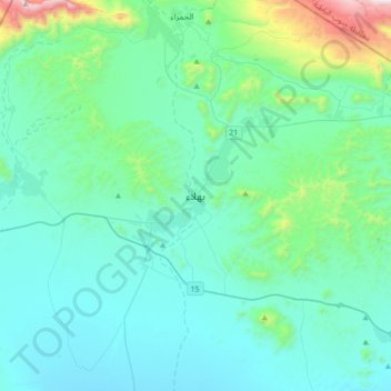
Name: Bahlā topographic map, elevation, terrain.
Location: Bahlā, Ad Dakhiliyah Governorate, 617, Oman (22.81003 57.13870 23.13003 57.45870)
Average elevation: 670 m
Minimum elevation: 454 m
Maximum elevation: 2,002 m
Thank you for supporting this site ❤️
Make a donation
Make a donation
Gear up for your next adventure:
As an Amazon Associate, this site earns from qualifying purchases at no extra cost to you.